Tag: google maps
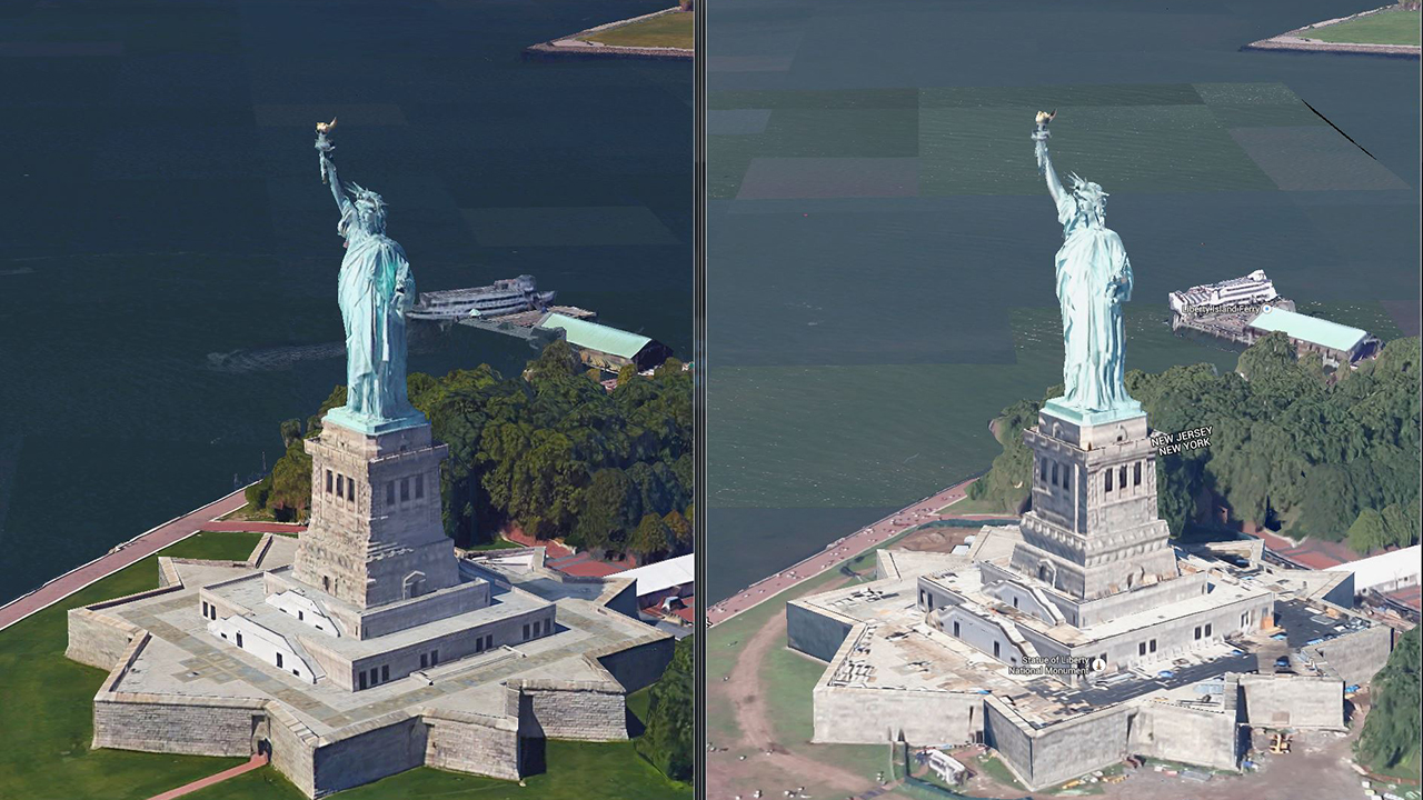
As impressive as they are invasive, Google Maps are about to get a lot more detailed. The company has introduced 3D imaging to Google Maps and Google Earth in San Francisco and New York, with more cities getting rendered in 2015. TechCrunch reports that the change comes from “better cameras and improved algorithms,” which really […]
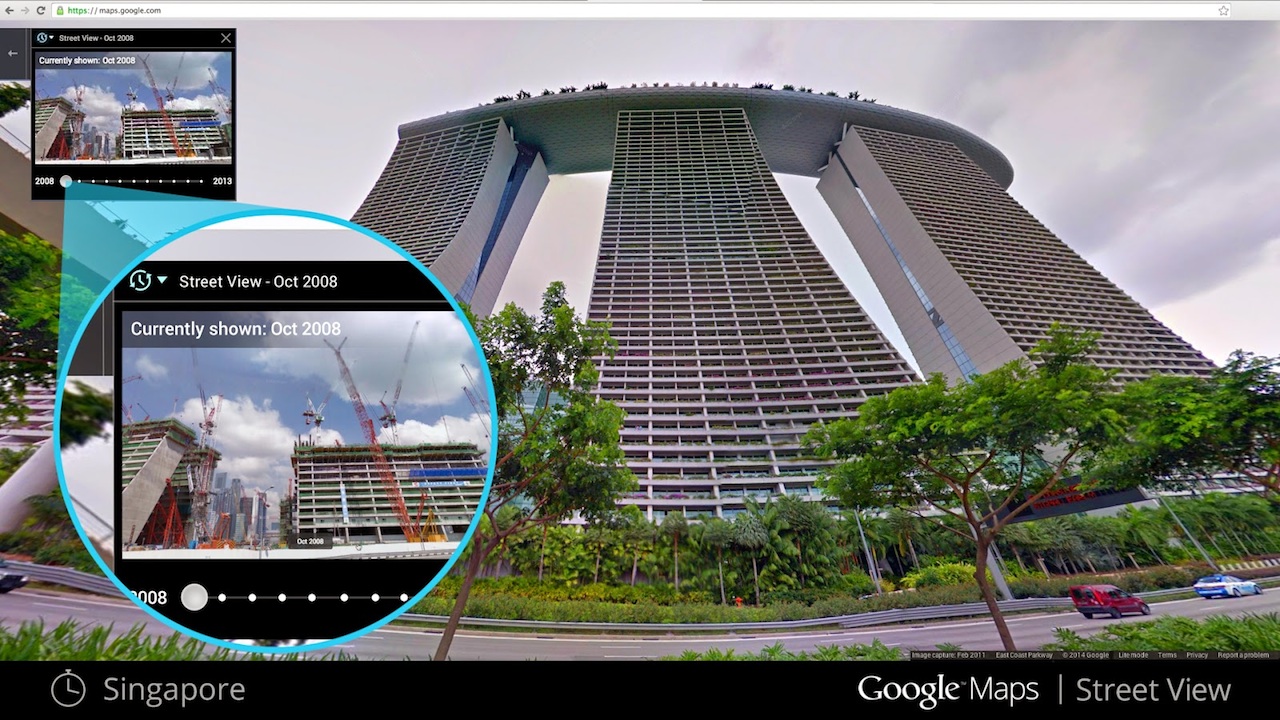
There’s a minor kind of magic that happens every once in a while when you’re using Google Street View. You’re stepping along when all of a sudden the landscape drastically changes — buildings change hands, gentrification marches on, natural disasters happen. Because of the patchwork way in which Google sends cameras out to update its […]
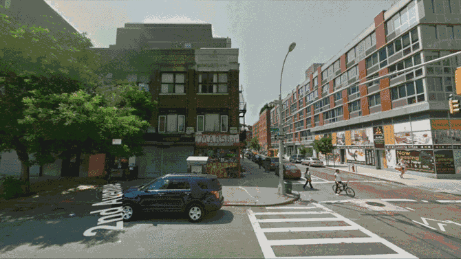
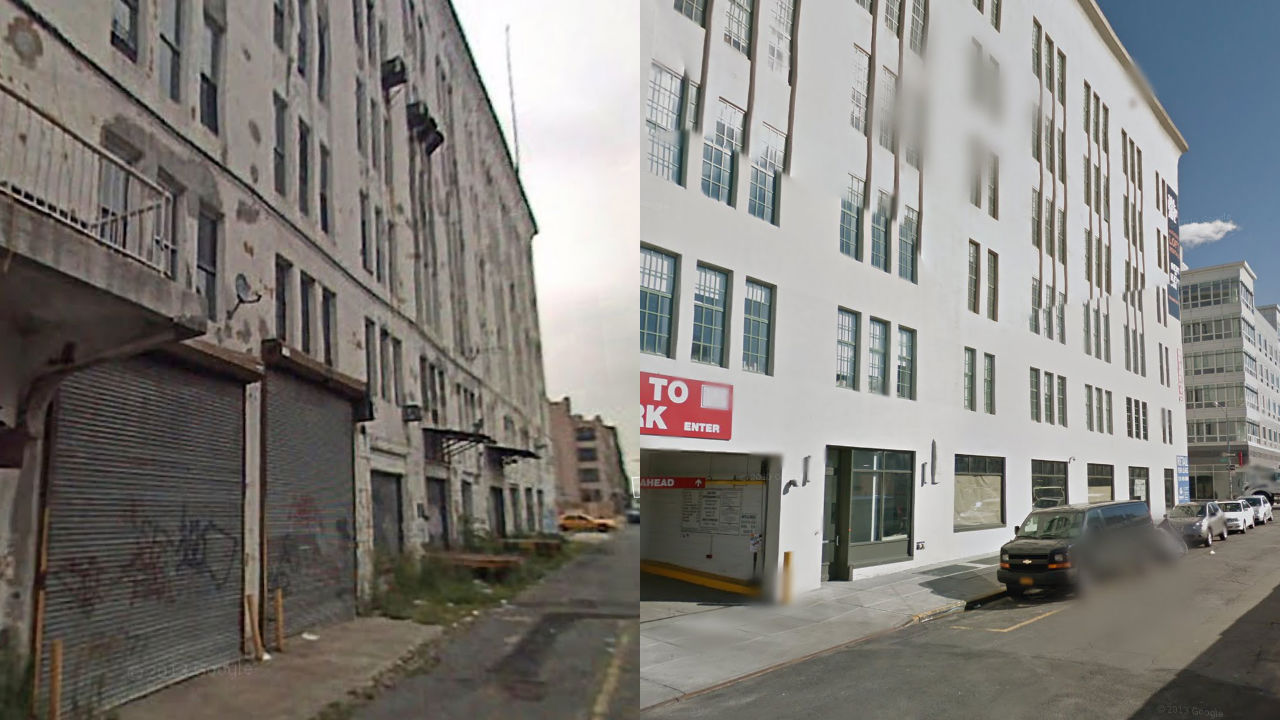
Last year, we showed you a bit of Williamsburg gentrification you could see happening before your eyes on Google Street View. Take one step down North 3rd Street near Kent Avenue, and a dilapidated warehouse turned into a shiny new apartment complex. Now, in a series called Vacated, artist Justin Blinder is building on that concept […]
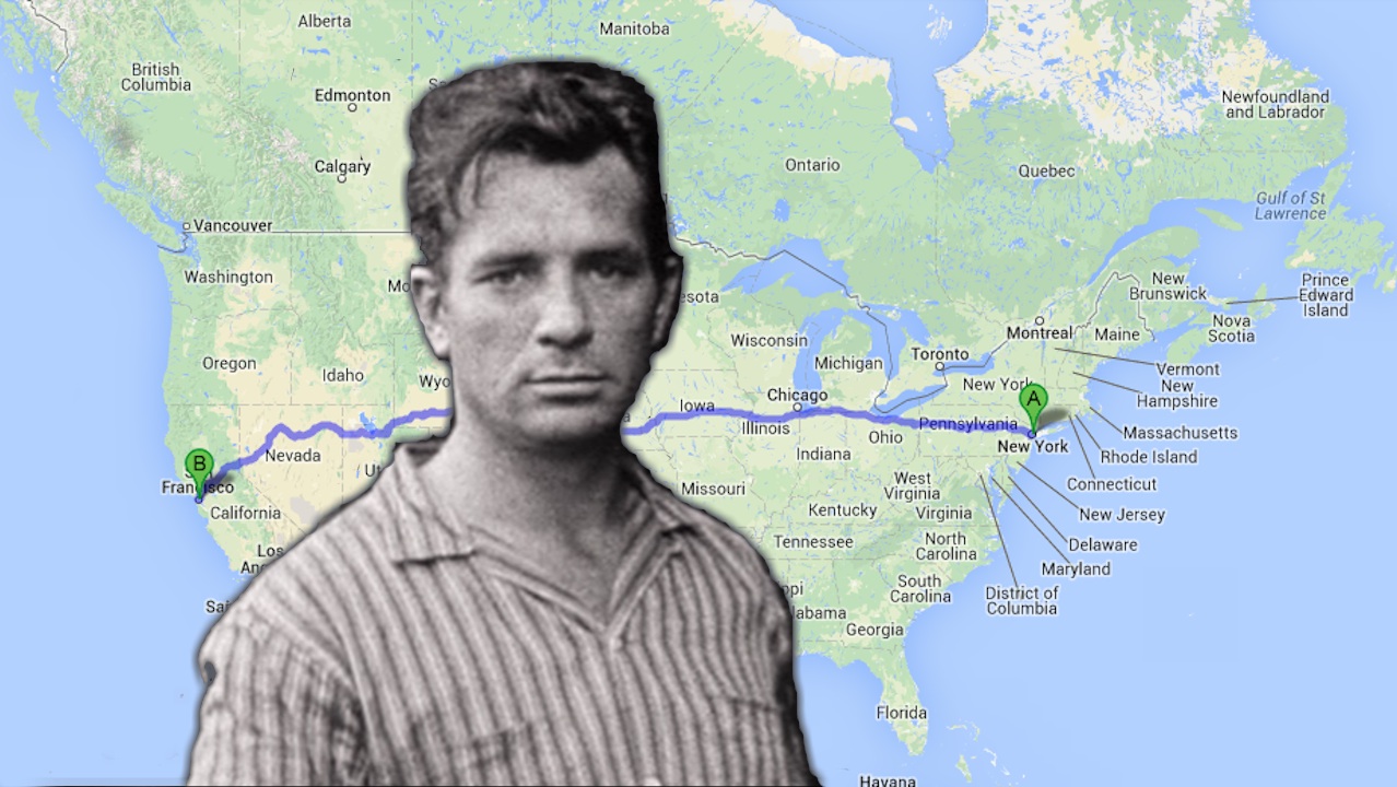
In case you want to replicate everyone’s favorite overrated Beat Generation novel, this is On the Road for 17,527 Miles, an ebook that catalogs every twist and turn in Sal Paradise’s epic cross-country journey as a set of Google Maps directions. “The exact and approximate spots Kerouac traveled and described are taken from the book and parsed […]
We love the time warps Google Street View accidentally creates when it juxtaposes newly-taken photos against older ones. First, there was a bank in Bay Ridge that changed hands as you walked; then, a scene of post-Sandy devastation jutted up against suburban tranquility on Staten Island. Now, thanks to Redditor stratomaster aka photographer Michael Tapp, here’s […]
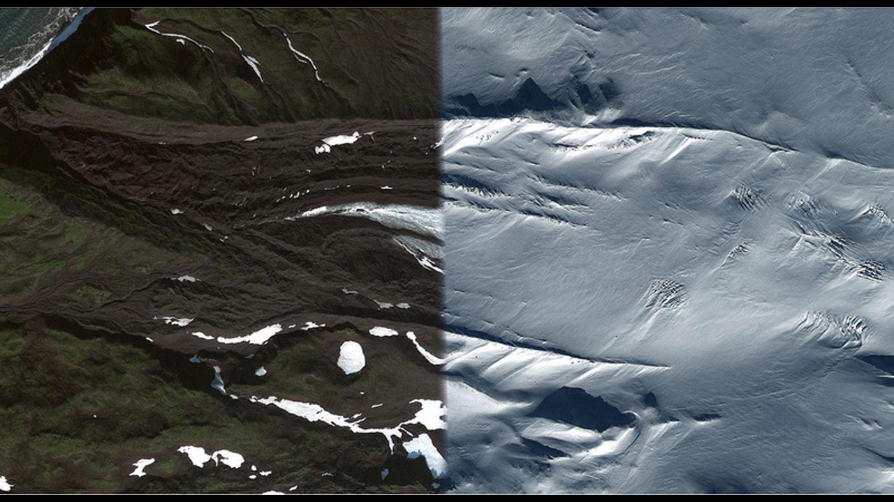
At some point during his Google Maps-scouring endeavors, German artist Daniel Schwarz noticed a strange phenomenon: the apparent coexistence of two contrasting seasons in the same place. Juxtapose is a collection of these glitched-out images, mostly of remote locations, taken directly from Google Maps. Although the satellite images give users a godlike power in jumping from […]
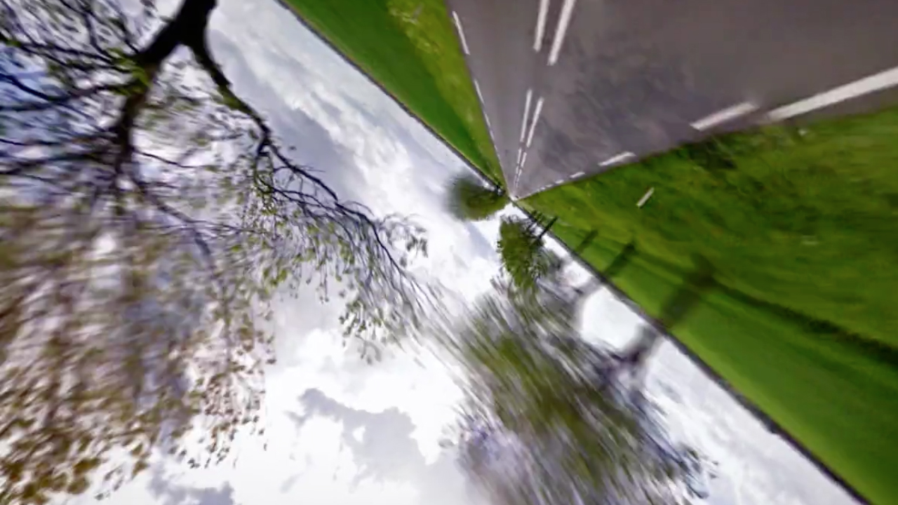
From kaleidoscopic Rorschach tests to fractal persian rugs, Google Maps has its nifty artsy uses. This might be the greatest one yet: Google Street View Hyperlapse, aka your favorite new time-sucker. Created by Canadian digital studio Teehan + Lax, the program stitches together thousands of images from Google Street View to create gorgeous, dizzying animated films that […]
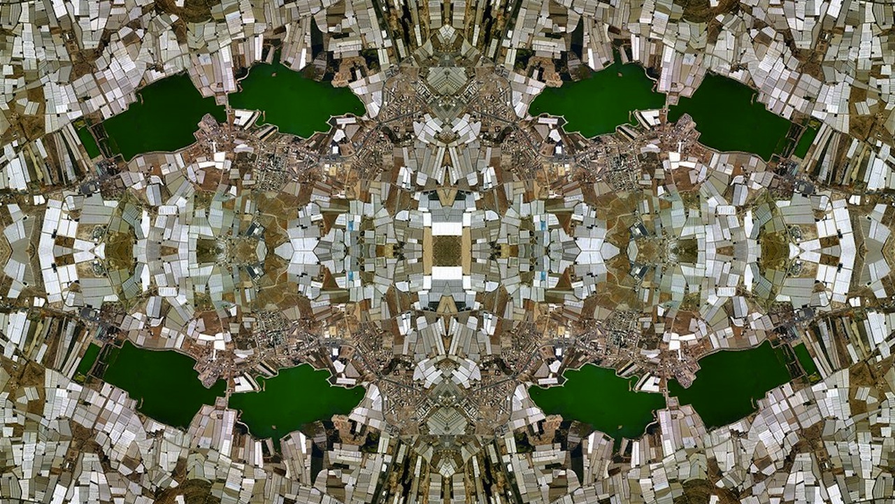
David Thomas Smith created these striking digital colleges by taking thousands of images from Google Maps, then stitching them together in Photoshop. And besides making the aerial view of your backyard look just like that totally trippy poster you had in college, the pieces have a more critical intent. By refracting the landscapes into repeating, kaleidoscopic […]
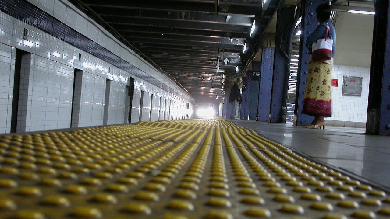
If you happen to regularly ride the 1, 2, 3, 4, 5, 6, or the Times Square/Grand Central shuttle, Google just got better at helping with your commute. In December, the MTA rolled out an app that provides real-time location data for trains on each of those lines, and announced it would the data available […]